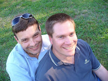
Friday, January 23, 2026

Red, green and gold


In October 1983, the Caribbean island of Grenada was invaded by the United States. This military action deposed a Marxist–Leninist government established four years earlier in a bloodless coup. The USA had become increasingly concerned about the nation’s close ties with Cuba, Nicaragua, and other communist bloc countries. Cold War tensions were rising at the time. Months earlier, Ronald Regan had publicly declared the Soviet Union an evil empire, and the Soviets had shot down a Korean airliner over the Sea of Japan.

The invasion marked the first time I recall ever hearing of Grenada. Yesterday, Garry and I visited this island nation as part of our Caribbean cruise. It proved to be another memorable and picturesque port. Our boat docked at St George’s, the nation’s capital, shortly before 9:00am. Once again, the forecast was for warm, humid, and sunny conditions, with a high of 26°C and a low of 25°C.

The island's surprisingly moderate climate gives rise to its reputation as the "Island of Spice. Stable tropical temperatures ensure the success of spice production, its primary export. Nutmeg is a key crop, followed by spices such as cocoa, mace, cloves, vanilla, cinnamon and ginger. Our cruise notes claim its the world's second-largest producer of nutmeg.


After breakfast, we joined a morning tour of the Clarke’s Court Distillery to learn the secrets of making great Caribbean rum. It was also our first formal visit to a Caribbean distillery. Interestingly, we learned that it no longer makes rum from locally grown sugar cane. Instead, the distillery imports molasses from other islands, mainly Barbados. We learned that most distilleries in the Caribbean now use imported rum. Apparently, in the absence of slave labour, sugar cane growing is an expensive exercise that generates relatively poor margins.

Our tour took us through the distillery’s old sugar cane mill. The equipment used for crushing cane and extracting its juice is still maintained in working condition. Once every few months, the ageing machinery is started, greased and left to run for a while. The crusher's massive cog wheels and rotating cylinders are certainly impressive (but weren’t in action during our visit).


Our tour guide then took us up a steep metal staircase to the distillery’s mezzanine level, where it still makes rum. Large, heated vats boil down molasses and prepare it for fermentation. Likewise, several impressive stainless steel distillation plants continue to extract the precious liquor from the fermented product.

As part of the tour, we indulged in a rum tasting experience. Our guide told us we could sample three rums from 16 different options. However, Garry and I ultimately sampled at least five each. Some were wonderfully smooth and dangerously easy to consume. Others had more heat and left their mark as they went down. I bought a bottle of Sorell-flavoured rum. Sorell is a native red flower that gives the liquor a cranberry-like flavour. Who doesn’t like Cranberry vodka?


Our morning tour finished with an excursion to Morne Rouge Beach, where we enjoyed another dip in the Caribbean, a few complimentary cold beers and some sunbathing. According to Google Maps, we were hosted by the Beach X-scape Bar, a simple, wooden pavilion set back from the beach itself. We then returned to the Silver Shadow for lunch, driving along the capital’s scenic waterfront and through the Sendall Tunnel linking its horseshoe-shaped inner harbour with a cruise terminal on the Caribbean coast.

According to Wikipedia, the harbour is an old volcanic crater. Our cruise notes describe Grenada's capital as literally rolling down the ancient crater's sloping hills to an attractive waterfront decorated by floral-hued buildings, Georgian architecture and idyllic terracotta roofs. It's a very apt description.


Sendall Tunnel is a bit of an eye-opener. It’s a historic 105-metre passageway built in 1894-1895. The tunnel is only wide enough for one-way traffic. However, pedestrians happily pass through it in either direction, dodging traffic by staying close to the side wall as they walk. It’s hair-raising stuff.


After lunch, I decided to return to St George’s for a walk along its picturesque waterfront. My sweaty route included a transit through Sendall Tunnel on the way into town and again upon returning to the boat. Grenada’s Independence Day will be celebrated on 7 February. As a result, the town is currently decked out in the colours of the national flag in preparation for the big day. A flurry of red, green and gold was displayed proudly everywhere I walked. 

I made a complete circuit of the inner harbour from Sendall Tunnel as far as Cooper Hill. I then climbed a steep, grass-covered stairway that took me up to Mitchell Lane, a quiet street which follows a ridgeline overlooking the harbour. I had hoped the elevation would give me some memorable views of the town below, Fort George (an imposing fortification on the opposite side of the harbour) and the surrounding Caribbean coast. I wasn't disappointed. The steamy climb was well worth the effort, as you'll see from the images above and below.


I followed the road back down to Roy St. John Field, a large sports field next to the local container port. Local schools were hosting a sports day on the field. Colourful crowds were cheering on the children, while a hyped-up commentator was delivering a rousing scoreboard update. I then returned to the boat, passing the local fishing fleet, colonial stone-clad buildings and other memorable landmarks.  Delighted to report that I ultimately clocked up 10,384 steps yesterday.


Grenada is definitely one of my favourite islands so far. We've yet to visit three islands on this cruise, so I think it’ll remain a highlight.

Wednesday, January 14, 2026

Montserrat


On 18 July 1995, the dormant Soufrière Hills volcano burst into life on the island of Montserrat. This was the first of several eruptions that ultimately destroyed Plymouth, the island’s capital city. Almost two-thirds of Montserrat’s population were forced to flee, many relocating to the United Kingdom. By 1997, fewer than 1,200 remained on the island.

In the years since, much of Plymouth, including its central business district, has been progressively buried under ash and debris from repeated pyroclastic flows. These events have resulted in it earning the nickname, “Pompeii of the Caribbean”. The volcanic activity continues, generally affecting the vicinity of Plymouth, and the island's eastern side, which once housed its airport. The old airport was buried by flows from the volcano's most recent eruption in 2010. 


However, despite 16 quiet years, the volcano is still active: ground inflation and volcano-tectonic earthquakes are still recorded, and sulphur dioxide spews steadily from still hot fumaroles on its lava dome, forming a gas plume that descends towards the coast. Consequently, the southern part of the island is, to this day, considered by the authorities as uninhabitable and unsafe.

For as long as I can recall, I’ve wanted to visit Montserrat and see the buried city of Plymouth. In fact, if I’m honest, its inclusion on the cruise we booked definitely influenced our decision. Most cruise companies give it a miss as it lacks a wharf suitable for large cruise ships. The island can only be reached by tender, thus restricting access to smaller vessels like our ship, the Silver Shadow. 


Montserrat didn’t disappoint. Our boat dropped anchor shortly before 8:00am in Little Bay on the island’s northwest coast. After breakfast, Garry and I joined a minibus tour that took us down the island to Plymouth. Our route took us through several new settlements established to house the former capital’s diaspora, including Brades, the territory’s interim capital and the township of Salem.

In the hills above Salem lies the Montserrat Volcanic Observatory (MVO). This slightly jaded white semi-circular building was our first stop of the day. It was officially established in 1999 to monitor the restless Soufrière Hills volcano, assess its many volcanic hazards and risks, and attempt to forecast its future behaviour. It also offers an uninterrupted view of the mountain from a safe and relatively protected location.


Getting to the observatory was an adventure itself. The northern end of Montserrat is incredibly hilly. As a result, the road constantly climbed hills and dropped into deep ravines. The road from Salem was particularly hairy. It was incredibly steep, featured hairpin turns, and was paved with uneven, heavily weathered (i.e. potholed!) concrete. 

Sadly, the volcano’s summit was shrouded in low clouds during our entire time on Montserrat. However, its gently arcing flank was clearly visible from the MVO, as were remnants of its most recent pyroclastic flows. Below is an image of what we saw, along with what you can see on a good day. The observatory screened a short film about the 1995 eruption and subsequent destruction of Plymouth. This neatly set the scene for our next stop. 


Currently, the island is divided into a series of hazard zones. Zone 1, which covers its northern end, is considered safe to live in, while higher-rated zones in the south are considered progressively more hazardous. Zone 5, encompassing more than a third of the island's southern end, is currently an exclusion zone. Visitors aren’t normally permitted to enter it. However, authorised local guides can take visitors briefly inside if MVO staff grant approval on the day. 

Luck was on our side. Our minivans were given permission to visit Plymouth. To get there, we drove along Friths Road, over the Belham River, and around the base of Garibaldi Hill. Whenever Zone 5 is deemed too hazardous to visit, tourists are restricted to visiting a lookout on the hill. Apparently, sand is the island’s largest export earner as the local sand is perfect for making quality cement. As a result, the area bordering Zone 5 is a hive of activity, supporting several sand quarries. Our group passed several laden dump trucks and conveyers pouring freshly mined sand into large mounds. 


Before we knew it, warning signs marking the exclusion zone’s boundary came into view. I couldn’t believe I was about to tick off another bucket list experience. For the next three kilometres, we made our way to the coast through dense vegetation. Dirt banks on either side of the road were a stark reminder of the nearby volcano. Our guide reminded us that these were actually overgrown ash and pyroclastic deposits.

Our route into Plymouth took us past the town’s former technical college towards the remains of its main jetty. As we drove, ruined buildings came into view, some cloaked in vegetation growing in a layer of ash up to half a metre deep on their concrete roof. As we approached the coast, the scene became progressively more surreal.

The Molyneaux Building was one of the more surreal sights we encountered. This four-story building was built in 1989 as the corporate office for Cable and Wireless and the Government’s Audit Department. It’s built entirely of concrete and was the island's tallest building. These days, only its top two floors are visible. The rest of the building lies under almost seven metres of mud and ash. That’s it in the first image below.


The jetty was nothing to write home about. That is, until our guide pointed out that it once stretched more than 50 metres into the harbour. These days, thanks to the volcano, less than ten metres of jetty stands in open water as pyroclastic flows progressively create new land. Our guide shared images of the town before its destruction and spoke of fleeing with his child as a dark and deadly volcanic ash cloud descended on his home. We later learned that he once managed the island’s old airport before it was inundated by volcanic debris.

Looking back towards the volcano, we could see it gently rising behind the town. The smell of sulfur permeated the air. A large boulder field was visible in the distance. Our guide explained that these boulders were three kilometres away, making them appear deceptively small. They were actually the size of a small house or a large bus. Then he pointed to a misty haze shifting below the cloud line. This mist wasn’t cloud; it was venting gas and steam from the caldera drifting directly towards us. It was an eerie sensation watching the haze come and go as our guide spoke of the volcano's destructive history.


Once his presentation was completed, we returned to our minivans for a drive through the western edge of central Plymouth. The experience was truly mind-blowing. We drove by buildings filled to the roof line with mud and debris. We were driving on a flat road, which meant level ground was once several metres below us. This realisation was brought into stark relief as we passed the Flora Fountain Hotel.

The hotel, built in 1984, consisted of two adjacent buildings. The ground floor of one building housed Angelo’s Supermarket, distinguished by a series of arched windows. A second circular building housed a fountain in a central courtyard, hence the hotel’s name. The internet is filled with images of Angelo’s supermarket buried to the top of its arches. You can see my version of these in the final image above.  In the second image above, the building on the far left is the hotel's circular building just coming into view.

The first image above of a building with blue gables was once the Government Headquarters. What you can see here is actually the top floor of a two-story building. The bottom floor has long since been buried, along with a concrete portico embossed with the building's official title. If you don't believe me, check out the photo I’ve pulled from the web below. The Government Headquarters sits in the centre of this image.


Here's some additional context. I've pulled the second image above from the web. It shows Plymouth after one of the many volcanic lahars that have inundated the town over time. In the foreground, you can see a circular building. Look to the left. You'll see the distinctive window arches of Angelos Supermarket along the front of the adjacent building. Our tour drove past Angelos in the direction of the superimposed arrow. (Photo source: Science Photo Library).


Above you can see the upper floor of Arrow’s Manshop Store, a ruined building noted for its yellow window frames and two semi-circular wings. Nearby was an elegant office building, with arched windows still intact, but buried partway up to its second floor. Further on, more roofs appeared at ground level. At times, everyone on the bus audibly gasped as we passed one buried building after another.

Our guide saved the best for last. We stopped briefly outside St Anthony's Anglican church. Sitting on higher ground,  slightly north of the town centre, this area was never buried. Instead, a concrete-like layer of ash has settled on everything. Our guide invited us to step outside and take a few photos. He then invited a couple of us to follow him down the road. He took us around the side of a boundary wall surrounding the church, up a shallow dirt bank (more ash deposits!) and along the side of the building. 


Suddenly, we found ourselves standing in a doorway looking into the ruined structure. I couldn’t believe my eyes. Daylight broke through the gutted ceiling, revealing abandoned wooden pews and dramatic collonaded arches lining its central nave. Splashes of vibrant vegetation gave the entire scene a surreal post-apocalyptic feel. It was a magical moment. Hopefully, my photos have done it justice. I’ve also included an archived image of the church in its heyday.
 

The tour returned to Little Bay, where Garry caught a tender back to the ship. I decided to visit the local museum located on the edge of the island’s new cricket ground. Sadly, it was closed. However, the walk gave me a closer look at the island’s new white-walled, red-roofed Cultural Centre that opened in 2007. The island’s long-term plan is to transform Little Bay and the surrounding district into the island’s permanent capital. These new facilities, including a deep-water jetty, are being constructed progressively in support of this vision.

With little else to see, I caught a tender back to our ship for lunch. That's another item successfully ticked off my bucket list. I can finally say I’ve visited both the original Pompeii and its modern replica. The destructive power of nature is certainly a sight to behold, and just a little humbling. Garry and I also worked out that it’s the third active volcano we’ve visited. Previously we’ve explored lava flowing from KÄ«lauea in Hawaii and walked through the crater of Whakaari/White Island in New Zealand. We really must stop visiting active volcanoes!