Friday, August 31, 2012

Been there, done that

That's it. Our vacation is over. We're now at Seatac Airport in Seattle waiting to board our shuttle flight to LAX. We've spent our last morning sleeping in but did find time to drive up to Kerry Park on Queen Anne hill before heading for the airport.

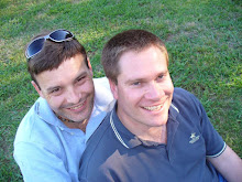
The park offers visitors a classic skyline panorama of Downtown Seattle with the Space Needle, Puget Sound and Mount Rainier framing the view. Unfortunately Mount Rainier has eluded us yet again. It's snow-capped peak was shrouded today by more low cloud. No doubt we'll see it towering above the clouds after take-off. Until then we'll just have to satisfy ourselves with the complimentary green screen photo supplied by the Space Needle.

Hertz has also confirmed that we officially drove a total of 2,303 miles, or just over 3,700 km since leaving LA. A quick search on Google shows the driving distance from Sydney to Perth is 3,936km. We've basically driven the width of Australia in less than three weeks. Phew! Time for a rest.


• Posted from my iPhone

Thursday, August 30, 2012

Nature at its finest

Tomorrow we fly out of Seattle bound for Los Angeles and onward to Sydney.  Our vacation is almost over.  However, it’s likely to end on a high note as overnight we secured an upgrade to First Class for our flight across the Pacific. Frequent flyer points do have some benefits!

As I reflect on three weeks in the USA is difficult to single out one highlight as there have been so many.  Our accommodation has been consistently good with only one exception.  That one exception was Camp Curry at Yosemite Park.  It’s somewhat ironic to see a news story overnight warning that people who’ve stayed here may have been exposed to the deadly hantavirus pulmonary syndrome.

Since June, four visitors who’ve stayed at Camp Curry in its hard wall tents have contracted the disease.  Two have subsequently died.  The virus is carried by mice and other native rodents.  Park officials warn that at least 1,700 are at risk, potentially including Garry and I.
 
We've subsequently learnt that the tent zone we stayed in was closed permenantly for the season nine days after our stay. Apparently this particular zone was the hot spot for exposure to the virus. We now have to watch for symptoms of a disease that can take up to six weeks to appear.
 
Aside from the disappointing accommodation, everything else about Yosemite was truly memorable.  In fact, both of the National Parks we visited have been well worth the detour inland.  Nature has really been on show everywhere we go.  The wildlife has been abundant.  The redwood forests are simply awe inspiring. The USA is a nation of stunning natural beauty.

 
UPDATE: September 2, 2012
Following a terse exchange with the organisation managing accommodation at Yosemite National Park I've secured a list of cabins used by HPV inflected visitors.  I'm relieved to report that we didn't sleep in one of these cabins.  It's also somewhat reassuring to see that the affected cabins are clustered at least 50-100 metres away from our cabin.  This suggests that the exposure risk for Garry and I is potentially lower than average.
 
UPDATE: September 7, 2012
News today that a third HPV infected person has died.  The unfortunate victim contracted the disease in June, as did all others who've fallen ill so far.  We also learnt today that health authorities shut down Camp Curry after discovering infected rodents had been nested in insulation the fills void of its hard wall tents.  In other words, earlier attempts to disinfect the cabins were potentially inadequate as the ultimate source of infection had not been removed.

Wednesday, August 29, 2012

Classic Seattle

Our first full day in Seattle was a day of classic iconic tourist sights and sounds.  We started the day with a walk to Union Lake to watch seaplanes taking off over the city.  We then headed into town to explore Seattle's increasingly gentrified Downtown district.  Our next stop took us through the heart of Pike's Market, a fresh produce and craft market filled with colour and noise. It was here that we stumbled across the original Starbucks Coffee Shop.

We finished our walking tour with a ride on the 1962 World Fair Monorail back to the Space Needle.  We used our 24 hour ticket for one final ride up to the needle's observation deck.  We had hoped to catch a glimpse of Mount Rainier, the highest mountain in the lower 48 states.  Unfortunately distant cloud cover had obscured the view.

Tuesday, August 28, 2012

2,250 miles later


We've made it! After a sun-soaked morning in Astoria, we've completed a four-hour coastal drive into Seattle. This is the final destination of our West Coast USA road trip. After travelling almost 2,250 miles we're now camped out at the Four Points hotel a few blocks north of Seattle's famous Space Needle. The photo above shows the view from our room.


We chose this hotel in part of its central location and in part because we could cash in some loyalty points and stay for free. Inevitably, based so close to the Space Needle, we couldn't resist an urge to walk the ten minutes it took to reach the tower's ticket booth.


From the tower's observation deck, perched 520 feet above the street, we spent a relaxing hour watching the sun's final rays fade over Seattle, followed by the first of the city's evening lights. Even the ferries crossing Pugent Sound took on a rather romantic quality in the rose-tinted light.

We have 2.5 days remaining in Seattle. Stay tuned for photos as we begin exploring our final city stop.

• Posted from my iPhone
• Location:Mercer St,Seattle,United States

Graveyard of the Pacific


Astoria proved a wonderful addition to our itinerary.  It had been a last minute addition literally weeks before our departure.  I'm glad we added it to the tour.  Astoria sits on the edge of the Columbia River, 14 miles from where the river meets the Pacific Ocean.  It's considered the oldest European settlement west of the Rockies and was once the USA West Coast fishing industry's main hub.  At its peak the town’s waterfront housed more than a dozen canneries.  Each cannery sealed thousands of tonnes of salmon annually.

Tuna was also canned here for several years after the salmon catch declined. According to the New York Times, Astoria is responsible for popularizing the iconic tuna fish sandwich, the staple of every diet-conscious American’s lunch. Says the NYT, “The town is…to canned tuna what Detroit is to the automobile.”  Astoria's fishing history was very much in evidence at the Columbia River Maritime Museum nestled on the downtown waterfront.  


In fact the museum was an unexpected highlight. Its exhibits are beautifully presented, with just the right level of detail to capture the essence of every fact and anecdote.  We quickly learnt that the bar across the mouth of the Columbia River is North America's most treacherous stretch of water. Since 1972, thousands of vessels have been ship-wreaked in the area earning it the title, “Graveyard of the Pacific.  As a result the US Coastguard operates a national training school on the river's northern shore.  They say that if you've mastered the bar here then you've mastered the worst nature will throw at you.

The museum brings home the challenge of crossing the bar in vivid detail with video footage and first person accounts of dramatic rescues.  However, these exhibits pale in comparison to the display of a retired lifeboat presented mid-rescue.  The full-size vessel is shown teetering precariously on the near vertical edge of breaking storm wave.  The entire scene towers dramatically over visitors bringing the drama and danger of storm rescue powerfully to life.

 
On a wooded hill above the town rises a 125 foot pillar, the Astoria Column.  This monument was built in 1926 to provide visitors with a sweeping view of the entire Columbia River mouth area.  A climb of 164 spiral steps takes you up to a narrow viewing platform.  However, the effort is worth every breathless moment as the view is simply stunning.

Perhaps the most dominant feature is the Astoria–Megler Bridge.  This green steel girder structure is 6.5 kilometres long and links Oregon with Washington on the north bank of the Columbia River.  The bridge was completed in 1966, completing the final gap in Highway 101’s route along the entire USA West Coast.  We’ve driven much of its length over the last few weeks.  It’s hard not to be impressed by this feat of engineering while safely crossing from shore to shore in a matter of minutes.

Monday, August 27, 2012

Astoria

Garry and I are making ourselves comfortable in front of a cosy gas fireplace in our hotel room. We've booked ourselves into the Cannery Pier Hotel in Astoria.  It's located on the bank of the Columbia River, the largest river of the west coast of the entire Americas.

The view from our riverside room is spectacular! We look out across the broad reach of the mighty Columbia River. At this point, less than four miles from the Pacific Ocean the river's width exceeds two miles. As a result, massive sea-going ships are able to make their way up river as far as Portland, more than 60 miles inland. we've already seen two sail past our window.

The drive here was also a day of milestones. First, we clocked up 2,000 miles on the road. We're now closing in on 3,500 kms of driving. Second, it rained several times this afternoon as we drove towards Astoria. This is the firat time since arriving in te USA that we've had anything other than blue skies and sunshine (coastal fog not withstanding).

Sunday, August 26, 2012

Portland


I’ve spent less than 24 hours in Portland until now.  Several years ago I briefly stopped here on a business trip while Garry flew on to Dallas, Texas where we had planned a vacation.  As a result, I saw very little of Portland, or its popular landmarks.  I recall the river and its many bridged but little else. 

Garry and I decided to base ourselves here for two nights as part of our West Coast road trip.  Originally it was simply a convenient midpoint between Crater Lake and Seattle.  However, we discovered there's plenty to admire about the city and its scenic location.

We arrived late on Friday after driving solidly for more than five hours from Crater Lake.  Our route took us north through the city of Bend and on past an elegant, snow-capped Mount Hood.  Our arrival at Mount Hood coincided with the region's annual Cascade to Coast fun run. Relay teams compete to run a route from Mount Hood to the Pacific Coast over a 12-hour period. 

As we drove towards Portland we found ourselves constantly passing runners, their supporters and race attendants along the highway. I must confess that Mount Hood proved a rather disappointing location. While the mountain is rather stunning, the township isn't. At one point I had  considered stopping here overnight rather than continuing on to Portland.  I'm glad we didn't.
On Saturday morning we drove into to town to soak up the atmosphere of the weekend market held along the banks of the Willamette River.  The markets get a prominent write up in every tourist reference.  Sadly, we found the market rather small and lacking character.  Ironically, we were more fascinated by the queue snaking out of Voodoo Doughnuts, another of the city’s iconic landmarks.  Voodoo sells all manner of sweet and savoury products including Maple Bacon favoured doughnuts.  We decided to give the queue a miss.

Instead we wandered through the old town and into the heart of downtown.  We discovered Macy’s Department Store was having a special one day sale.  Clothing already marked down up to 60% was being marked down an additional 25% if you agreed to donate $5 to a local charity.  It took very little maths to work out how much money we could save.  Needless to say both of us ended up spending hours at Macys buying an entire Summer wardrobe for a pittance.  For example, I grabbed a smart pair of Lacoste dress shorts for $11, marked down from an original retail price of $70

 With much of our sightseeing time consumed by shopping we decided to make our last stop of the day a little special.  We drove to Vista House located 30 miles out of town on a bluff overlooking the spectacular Columbia Gorge.  It was built in 1917 on one of the most beautiful scenic points on the original Columbia River Highway (a highway long since superseded by a non-descript interstate freeway).  The drive was worth every minute as the view was simply stunning.

Our final day in Portland actually saw us drive south out of town to McMinnville, home to the Evergreen Aviation & Space Museum.  I begged Garry to add this destination to our itinerary after learning that the infamous Spruce Goose was displayed here.  This aircraft, completed in 1947 under the personal instruction of Howard Hughes, is the largest ever built from wood.  At the time of its completion it was by far the world’s largest plane.

The Spruce Goose was decades ahead of its time.  This reality is brought into stark contrast by a small Douglas DC3 that sits under one of its wings.  At the time of its completion most commercial air passengers were still flying in these tiny aircraft.  It would be another 20 years before anything of a similar scale was built; that is, the Boeing 747.  It truly is an enormous aircraft.

The museum proved to be a pleasant surprise.  The complex consists of three spacious, light-filled, elegantly designed buildings.  Each contains cleverly designed exhibits that offer just the right level of detail to keep the most jaded visitor enthralled.  Even Garry had to admit that it was better than he’d expected.  This is high praise considering the number of similar venues I’ve reluctantly dragged him into over the years.

I was also excited to discover the original X-38 test vehicle on display.  This was originally developed as an emergency lifeboat for the International Space Station.  However, the entire project was cancelled in 2002 when space station construction over-runs gutted NASA’s annual budget.  Sadly, the 80% scale model on display was the only craft ever built.  It was used to test the X-38’s aero-dynamic characteristics. 

Saturday, August 25, 2012

Friday, August 24, 2012

Images of Crater Lake

Without doubt the vivid blue vista of Crater Lake has been a real highlight of our road trip.  Here are just a few images of our all too brief visit.  The first two images above show a rock island on the lake's eastern shore called the Phantom Ship.  It's so named for the rocky crags said to resemble the sails of a tall mast ship.  The second island shown here is Watchman Island, the most prominent feature of Crater Lake.

I've also included a couple of panoramas that I've stiched together using an application called Autostitch.  Sadly, these barely do justice to the actual vista that literally wrapped around us as we stood on the rim of Crater Lake. Click on each panorama to bring up a more dramatic full screen image.


Finally, let me leave you with these two images.  The first is a friendly chipmunk that literally ran up to my feet during one outlook stop at Crater Lake.  The second shows the road leading east away from the National Park.  Crater Lake sits almost 7,000 feet above sea level.  As a result, all roads leading into the park progressively rise with every mile that passes.  The western entrance winds up through attractive river valleys while the eastern entrance crosses a broad plain of ancient volcanic ash that you can see in the final image.