New South Wales is currently experiencing its worst start to the bushfire season in more than two decades. Today's fire warning map is a real eye-opener. Fire warnings and active fire zones now stretch almost 1000km from Brisbane to Sydney (that's the coastline visible in the map above).
More than 3000 firefighters are currently on the ground across the state, supported by 60 aircraft. There are 71 fires burning along the coast. Eight are at an emergency level, 10 at watch and act rating and 40 remain uncontained. One fire alone, west of Coffs Harbour, was 150,000 hectares in size, with a perimeter of 1000 kilometres.
Today's weather forecast is predicting highs of 38C and winds of up to 80km/h for the Greater Sydney region. Fire authorities have issued a "catastrophic" rating fire warning for Sydney. This rating effectively means that if a bushfire breaks out today any home or structure in its path won't survive the firestorm that engulfs it.
We last saw bushfires this destructive and pervasive in 1994. During that year, bushfires closed every road out of the greater city basin with the exception of the Hume Highway. Multiple bushfires raged within bushland around the harbour, in the Blue Mountains and across the Hunter Valley.
This year much of the state is entering its fourth year of intense drought. Dry conditions have left hundreds of thousands of hectares of forest, bushland and farmland littered with deadly levels of Dry, combustible fuel. Already this season we've seen normally moist and dense rainforests burning in Queensland; a phenomenon never recorded or witnessed since European settlement began more than two centuries ago.
Fingers crossed we have a boring day!
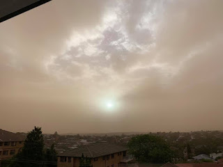
Temperatures in our suburb hit 37C today. The sky was transformed into an eerie lavender and sepia haze this evening as the winds slowly swung south. No major fires broke out in Sydney and a few flare-ups in the Blue Mountains were quickly brought under control. Tomorrow’s fire rating remains at a “catastrophic” level.
UPDATE: 19 November
This morning we woke to another day of incredible smoke haze drifting across the city. This photo published by Reuters shows just how pervasive the haze is throughout the inner Sydney basin today.
UPDATE: 21 November
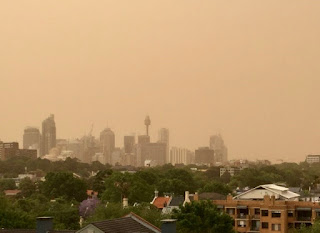
This morning we woke to another morning of extraordinary smoke haze. Here's the view from our balcony. As you can see the city skyline has simply vanished. Our outdoor furniture also smothered by a growing film of gritty brown dust.
Overnight the Australian Bureau of Meteorology released its long-range forecast for Summer. The bureau says it's likely to be much hotter than the nation's normal "average" temperature of 27.5C; with drier than average conditions. The following map highlights in red those areas where the probability of this forecast exceeds 80%. We've also woken to yet another day of smoke haze across the city skyline.


No comments:
Post a Comment